

Location
Location address is:
40 Laurin Loop Rd.
Sheridan, MT 59749
GPS coordinates:
45° 21' 11" N
112° 07' 15" W
Elevation: 5,104 ft.
Maps & Directions
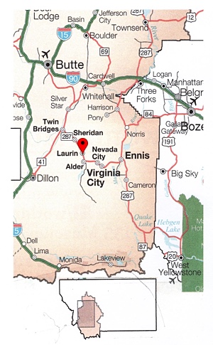
The first of these 3 maps is an inset of the state of Montana. You'll see a small red location marker near the center of the map. It marks where Laurin is located.
From I‑90 at Whitehall, take highway 55 south, then 41 south to Twin Bridges. From there, take 287 southeast through Sheridan and to Laurin.
Butte (close to the top-left of the map, on I‑90) and Bozeman (on the right side of the map, also on I‑90) both have airports.
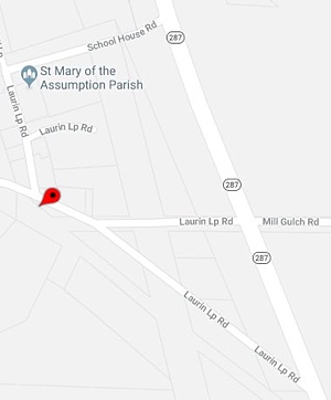
Here, you'll see the 3 possible exits from highway 287 that lead to Laurin. Any of the 3 will do. The red location marker is Ruby Riverfront Retreat at 40 Laurin Loop Rd.
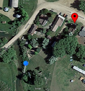
Below is a satellite image of the Ruby Riverfront Retreat.
Near the top-right of the image, on the south side of the road (Laurin Loop Road), you'll see a red location marker. That is the arriving point at the historical residence. GPS coordinates are 45° 21' 11" N and 112° 07' 15" W.
Near the lower-left of the image, you'll see a pushpin with blue-ball gripper and silver post. It marks where the Ruby Riverfront Retreat reaches the Ruby River.
For clarification or assistance, use one of the contact methods presented at the contact page.